 MADAMAGAZINE Your Magazine about Madagascar


As you already know from many tropical countries, many of Madagascar’s streets are rather sandy pathways or muddy tracks than drivable roads. More than 90% of the streets are not paved, which makes travelling time-consuming, especially since distances between national parks or other things worth seeing are mostly very far. Generally, a small network of larger streets leads across the country – those are called Routes nationales, abbreviated RN. The RNs are mostly two-lane (one lane per direction) and paved. Speeds up to maximally 80 km/h are the rule. In case of potholes and similar do not expect to exceed 50 km/h. Madagascar has no highway as you know from Europe or America. For many streets, you definitely need a 4×4 and an experienced driver – and even a knowledgeable driver can only drive at a walking pace on many small side roads.
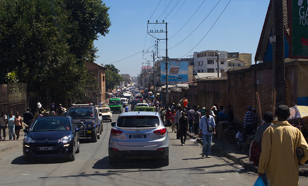
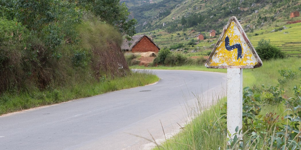
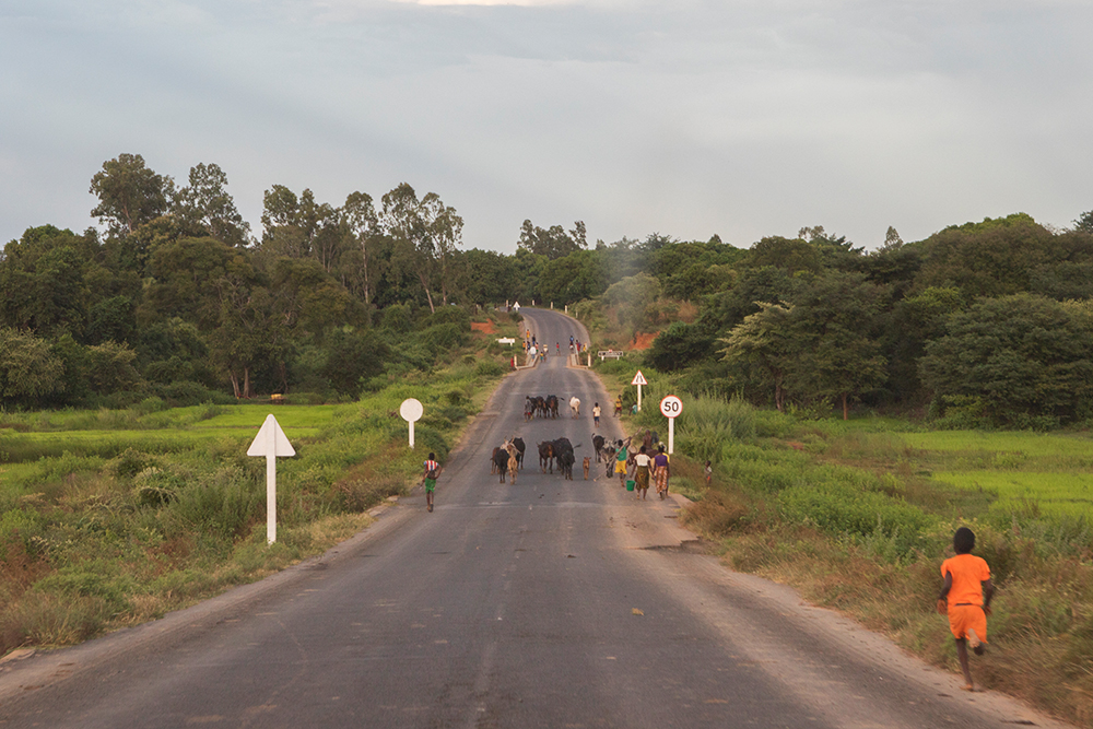
In Madagascar, they drive on the right. They also have worldwide used road signs and rules, but people love to ignore them. Inside big cities, the traffic often becomes so tight that you have to slow down at a walking pace or stop every other minute completely. For example, the capital Antananarivo provides an impressive variety of traffic jams and narrow traffic junctions, and an even bigger amount of cars, Taxibrousse, Taxi Be and scooters. Welcome to the survival of the fittest! However, some piping policemen try to get the situation under control from time to time. Mostly unsuccessfully.
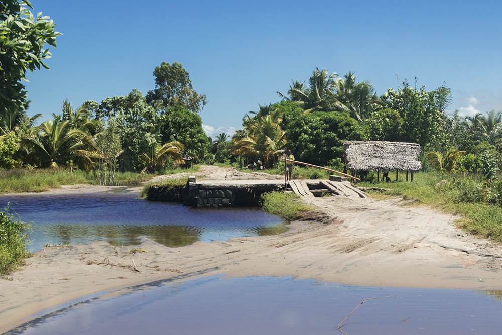
In general, you have to expect large potholes, impassable bridges at short notice, and other obstacles everywhere in Madagascar. If obstacles have been there for a while, they are usually marked by warning triangles or – more usual – cut-off branches are thrown on the lane. Due to the varying conditions of the streets, people are used to driving only during the daytime. After sunset, driving can become quite dangerous even on better RNs.
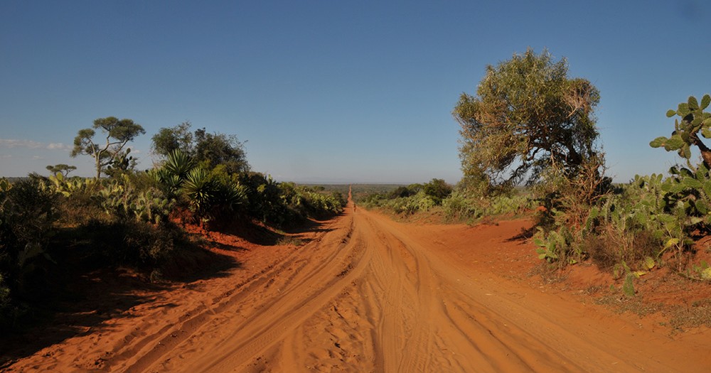
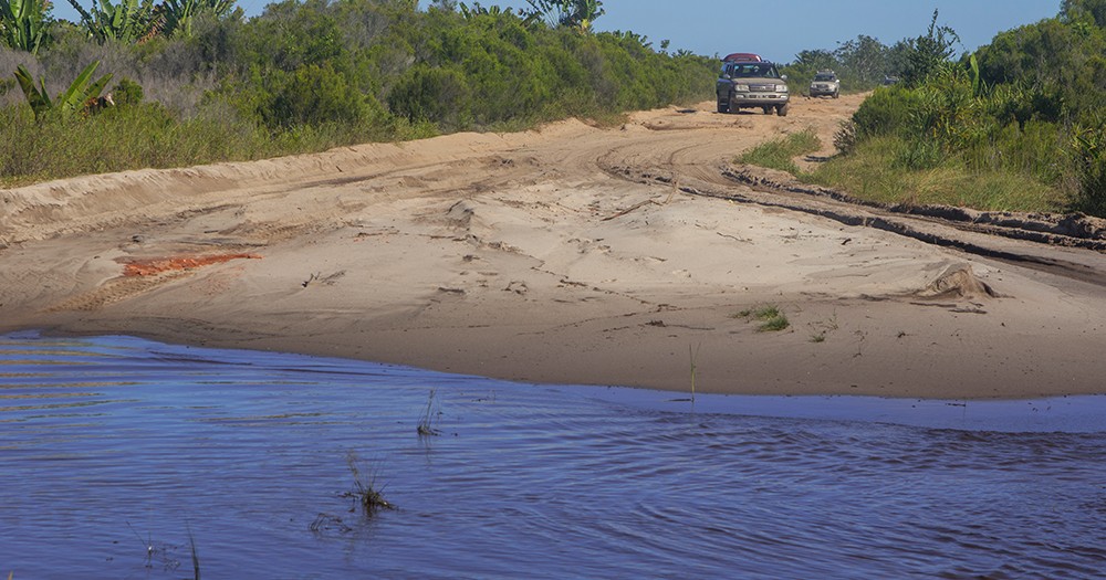
Outside Route Nationales and big cities, the road conditions are very various. From dry paths to tracks filled with mud and sludge, laterite courses smooth as a mirror, and hardly drivable sand dunes – in Madagascar, you can find every kind of street. The conditions of many sideways depend decisively on the weather. You simply cannot reach some villages after some days of heavy rain. And be careful: Some streets that are drawn on official maps as normal roads can turn out to be not drivable anymore when arriving there. As a consequence of the hard climate, Madagascar’s streets can change in less than one year from “well drivable” to “hardly recognizable as a street”.
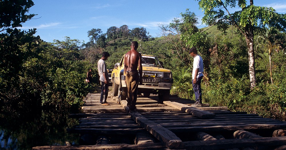
Repair and expansion of Madagascar’s streets go on slowly and dragging. In many places, people help themselves by filling potholes with gravel and sand. Broken bridges are also mostly repaired by hand, or people look for adventurous crossroads paths to bypass. Even larger bridges can be completely broken after natural disasters like cyclones.
The following is a survey of the most driven RN of Madagascar and their up to date condition as seen by MadaMagazine staff:
RN2
This RN is located between the capital Antananarivo and Toamasina (Tamatave) on the east coast. Some years ago, it was in quite a good condition, but aggravates visibly now: On and on, potholes and cracks become more and more. But still, the RN2 is completely paved and quite well to drive. The 141 km between Antananarivo and Andasibe currently takes a good four hours.
RN3
This Route Nationale is mainly asphalted and easily passable with off-road vehicles. It leads from the capital Antananarivo to the northeastern highlands to Anjozorobe.

RN4
If you want to visit Madagascar’s North, you have to drive RN4 from Antananarivo to the direction of Mahajanga. This street leads 570 km to the west of the island. Nearby Ankarafantsika, RN6 begins. Until Ambondromamy, RN4 is paved and well to drive. The beginning inside the central highlands is curvy and leads through very hummocky, bleak regions.
RN5
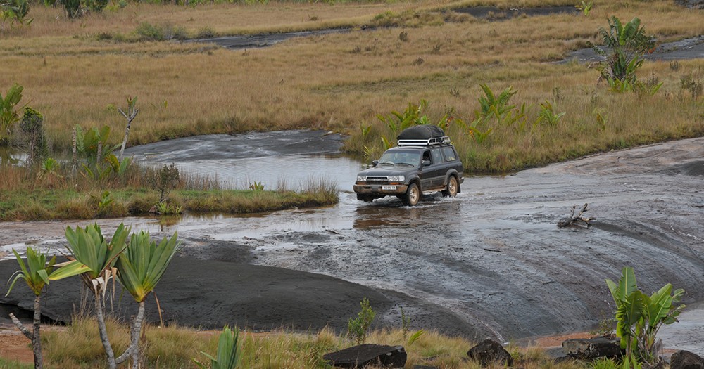
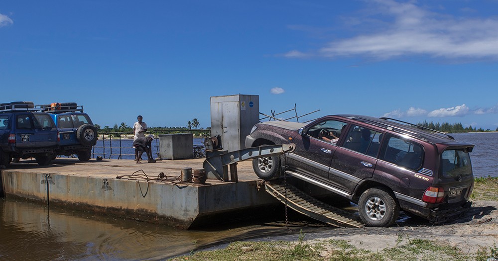
RN5 leads from the east coast city of Toamasina to Maroantsetra in the northeast, almost 400 km along Madagascar’s east coast. It is with good reason infamous as Madagascar’s most dangerous street. Until Soanierana Ivongo, the RN5 is easy to drive and paved. But right after the first ferry, only a sandy slope is waiting for you with endless, sometimes enormously deep, water-filled holes.
The more you come into the north, the worse becomes the street, until it is hardly a bad sand path. During the rainy season, RN5 transmutes into impassable mudslinging, in which trucks sink in until the roof and even Unimogs cannot pass. Between the track sections, there are many ferries only fit for scrap, for which you have to bring your own car batteries and gasoline. In the northern parts behind Manompana, you have to cross several self-built instable wooden bridges, sand sections on beaches, and laterite hills smooth as a mirror. Only very experienced off-road drivers can deal with RN5, and you have to bring your own car mechanic as well as any kind of spare parts for your 4×4. How much time you need on RN5 from one village to the next cannot be proposed due to the many unexpected but probable problems on the street.
The only exception is the RN5a between Sambava, Vohémar and Ambilobe. The part between Sambava and Vohémar has been passable for years. The stretch between Vohémar and Ambilobe, which was previously virtually impassable, was resurfaced in 2022. Parts are not yet asphalted, but already gravelled. This makes the road bumpy, but surprisingly “fast”.
RN6
If you came from RN4 and want to continue your trip to the North, you have to change your direction to RN6, which comes from Ambondromamy near Ankarafantsika national park and leads to Antsiranana (Diego Suarez), the northernmost part of Madagascar. In the last years, RN6 has been suffering a lot but has been only hardly repaired. Many parts of the street are not paved anymore or have so many potholes that you can only drive very slow. North of Ambanja, the situation worsens enormously. Unfortunately, there are more laterite cavities into which whole trucks fit than an intact roads.
RN7
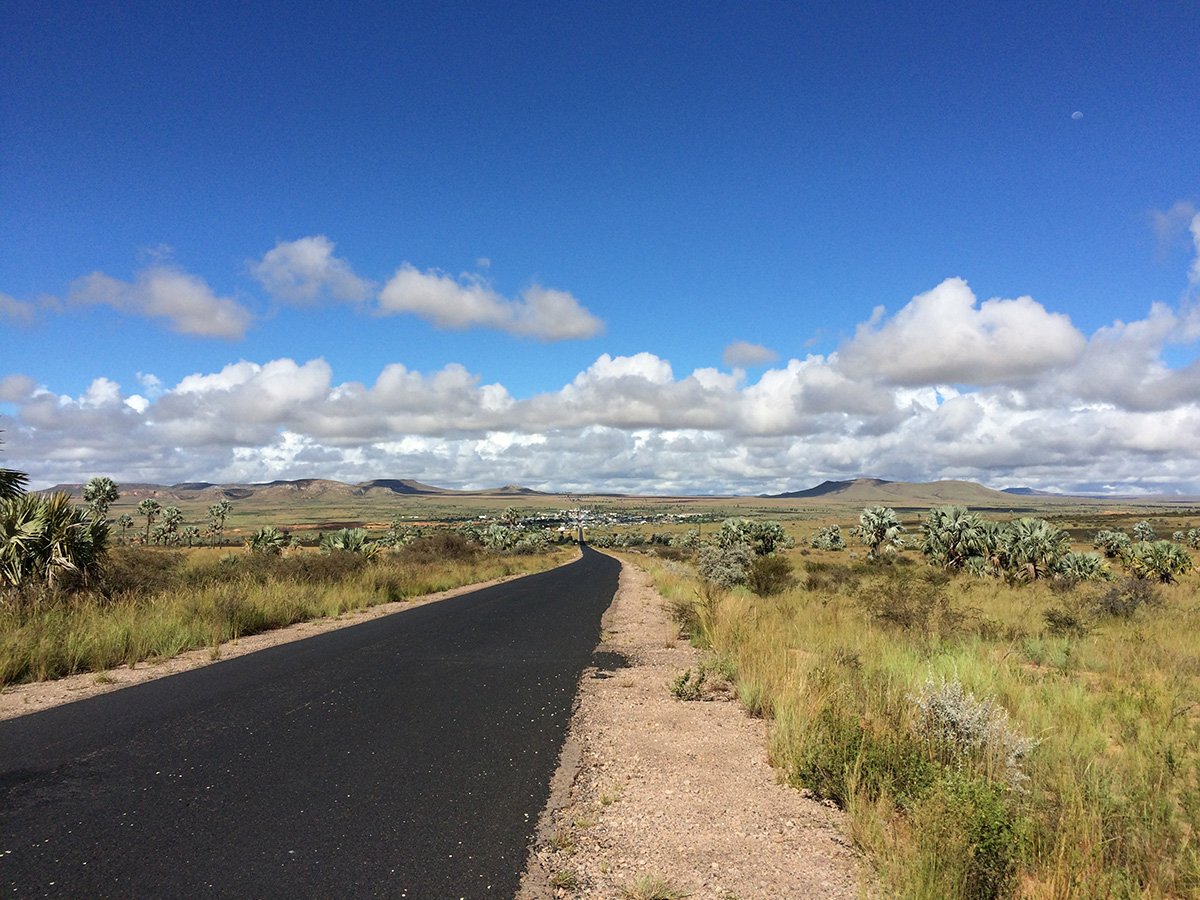
RN7 leads about 956 km from the capital Tana via Antsirabe, Fianarantsoa and Ambalavao as well as Ranohira (Isalo) to the deep south and Toliara (Tuléar). Especially concerning the economy, it is one of the country’s most important roads. The part in the southern highlands is very curvy. From Ambalavao, the curves become less, and then RN7 leads straight ahead for many kilometres. From Ambalavao until Toliara, RN7 is still one of the best streets in Madagascar.
RN8
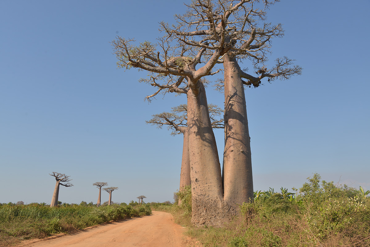
This RN has never been paved but is a sandy slope between Morondava in the west and Bekopaka (nearby Tsingy de Bemaraha national park). Here you are really lost without a 4×4. During the rainy season, RN8 is often impassable. But in recent times, there are also remarkably wet stretches of the road during the dry season: Residents flood the street intentionally sometimes to earn some Ariary by helping to pull cars out of the mud they got stuck in. The famous baobab alley is part of RN8.
RN13
RN13 is one of the roads rarely driven by tourists. It leads 493 km from Ihosy in south Madagascar to Tolagnaro (Fort Dauphin). Official statements say the RN13 is still paved, but practically it mainly consists of dusty slopes and potholes. If you drive this road, you better have a lot of spare tires with you.